Electromagnetic water meter
NB-IoT remote water meter
NB-IoT bluetooth remote water meterHot-line:
0757-28997001
About
-Product
-
Electromagnetic water meter
NB-IoT remote water meter
NB-IoT bluetooth remote water meter
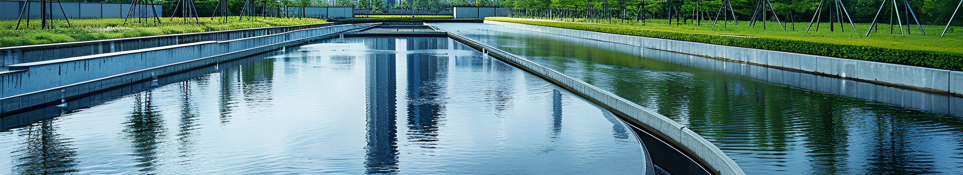
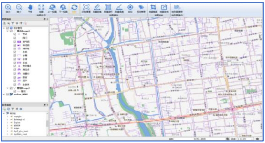
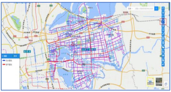
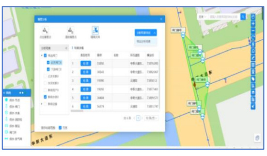
Smart Water Platform
-News
-Partner
-Contact
-GIS geographic information system is a set of platform for integrated display of attribute data and spatial data of water supply pipeline network developed based on current advanced geographic information mapping, big data analysis and other technologies, realizing the water company's control of underground assets, integrating the basic information of pipeline network, and facilitating the management of pipelines and their related attributes. It forms the processing flow of pipe network inspection-repair-receiving materials, and realizes the whole process of supervision such as querying, statistics, editing, checking and warehousing of pipe network data. Effectively help the personnel of water supply and drainage enterprises to efficiently carry out important daily work such as collection, early warning and processing of water supply pipe network status. | |
GIS Geographic Information Editor ————————— Support multiple sources of pipeline data in CAD, SHP, EXCEL and other formats for convenient entry, online and offline editing. | Pipe network search ————————— Support the query to show the direction of different types of energy supply pipeline networks in the city's geographic map. |
![]() | ![]() |
Synthesized analysis ————————— Provide section analysis, pipe burst analysis, water outage analysis, maintenance analysis and other analysis functions. | GIS Mobile Applications ————————— With the help of mobile communication technology, it realizes real-time outdoor pipe network browsing, querying, statistics, analysis and other application functions, providing support for multi-scenario application of pipe network. |
![]() |
|
GIS geographic information system is a set of platform for integrated display of attribute data and spatial data of water supply pipeline network developed based on current advanced geographic information mapping, big data analysis and other technologies, realizing the water company's control of underground assets, integrating the basic information of pipeline network, and facilitating the management of pipelines and their related attributes. It forms the processing flow of pipe network inspection-repair-receiving materials, and realizes the whole process of supervision such as querying, statistics, editing, checking and warehousing of pipe network data. Effectively help the personnel of water supply and drainage enterprises to efficiently carry out important daily work such as collection, early warning and processing of water supply pipe network status. |
GIS Geographic Information Editor ————————— Support multiple sources of pipeline data in CAD, SHP, EXCEL and other formats for convenient entry, online and offline editing. |
![]() |
Pipe network search ————————— Support the query to show the direction of different types of energy supply pipeline networks in the city's geographic map. |
![]() |
Synthesized analysis ————————— Provide section analysis, pipe burst analysis, water outage analysis, maintenance analysis and other analysis functions. |
![]() |
GIS Mobile Applications ————————— With the help of mobile communication technology, it realizes real-time outdoor pipe network browsing, querying, statistics, analysis and other application functions, providing support for multi-scenario application of pipe network. |
|